WHAT’S GOING ON?
A spin in the mid layers of atmosphere located over Georgia will continue to drift towards the Gulf of Mexico off of the Florida Panhandle by mid-week.
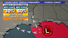
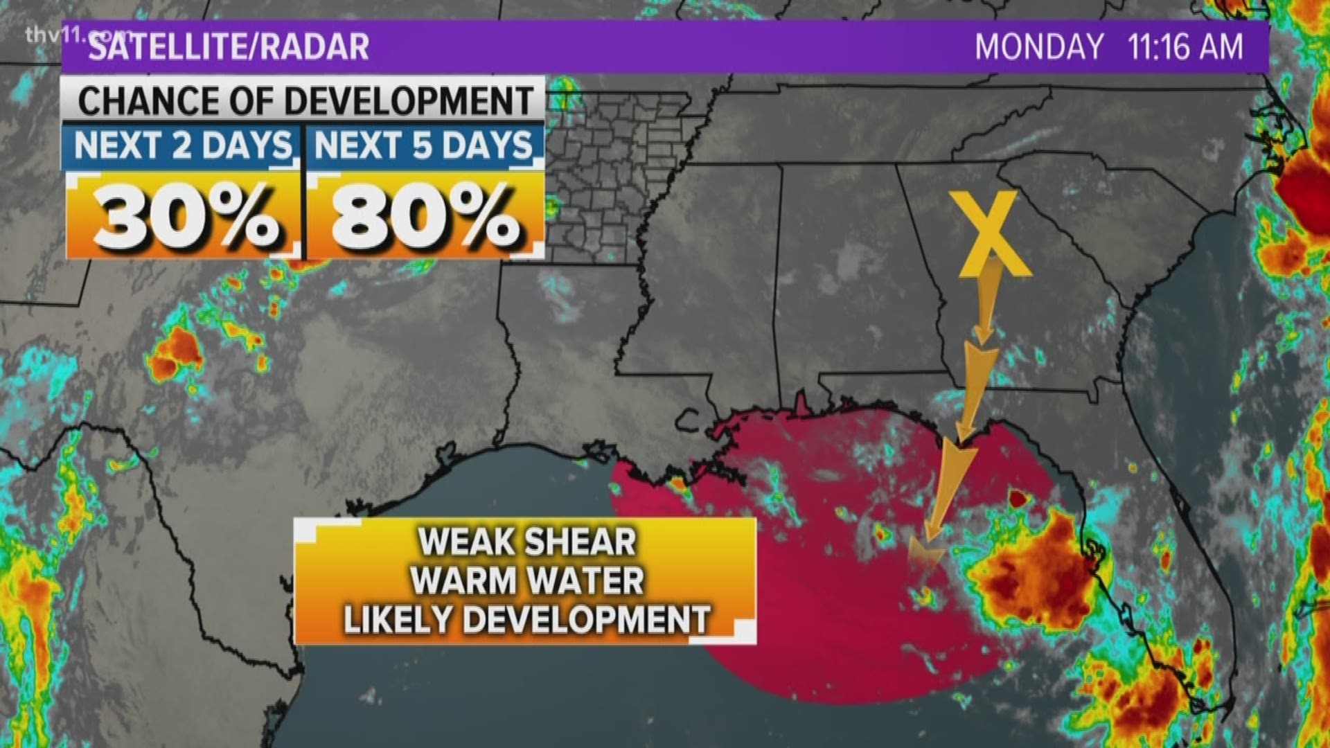
The National Hurricane Center is expecting the spin to develop a new surface low-pressure system and eventually a tropical depression (a level below tropical storm) by Wednesday or Thursday.
The NHC has given an 80% chance of a tropical depression forming in the next five days.
The environment over the Gulf of Mexico is favorable tropical development with this system due to very warm water and low wind shear in the area where the upper-level system is expected to migrate.

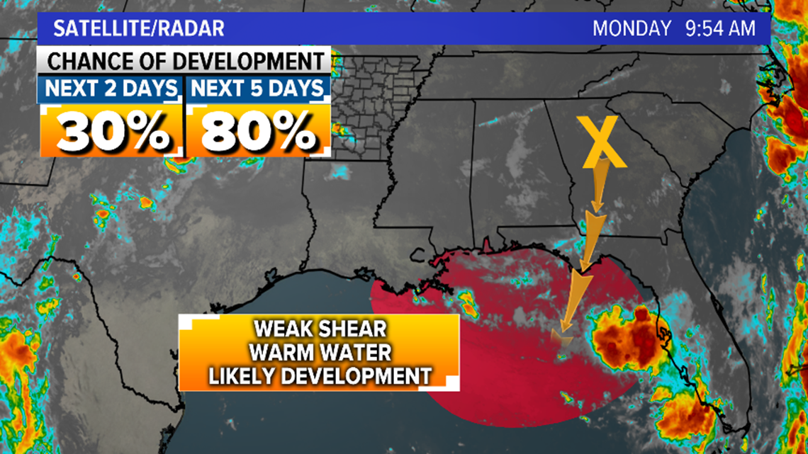
Since the storm is undeveloped, weather information trends are being watched very closely, but there is high confidence that a disturbance will develop in the Gulf of Mexico later this week.
WHAT TO EXPECT
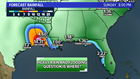
A tropical depression or tropical storm is likely to form by Thursday or Friday off of the Florida Panhandle or Mississippi and Alabama coasts.
The steering currents are expected to take the system west along or off the coast of Mississippi and Alabama by Thursday, and then the potential tropical storm will be churning off the coast of Louisiana by Friday.
Saturday the system may be making landfall as a tropical storm in Louisiana or Texas. The biggest question at this time is the strength of the system.
SHOULD I CANCEL MY BEACH PLANS
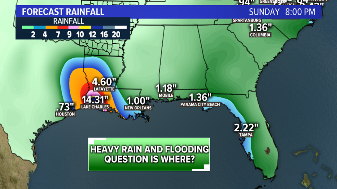
No, I would not cancel any plans at this time. However, do expect the potential of torrential rain for MS, LA, and TX. The flooding threat will be very high where the center of the system makes landfall. There could also be severe weather with the potential of tornadoes.
Expect rough surf and rip currents which could make it dangerous for swimmers and beaches may be closed.
Highest impacts look to be LA and TX due to the heavy rain and the forecast of the path. The core of heavy rain could shift west or east. Confidence is high that there will be a corridor of flooding rain in LA or TX.
HIGHEST RISK:
The highest risk of seeing flooding rain and gusty winds from what could be Tropical Storm Barry is Texas and Louisiana. This includes Houston, Beaumont, Lake Charles, and New Orleans.
ARKANSAS IMPACTS:
With the current path expected to move into LA or Texas this weekend, there is the potential for rain to creep into Arkansas from Sunday into Monday.
Depending on the track the rain could be a few showers or a deluge producing several inches. We will have a better handle on what if any impacts Arkansas can expect in the coming days.