
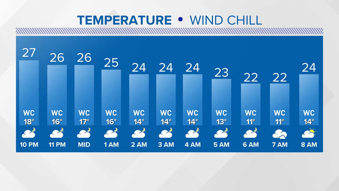
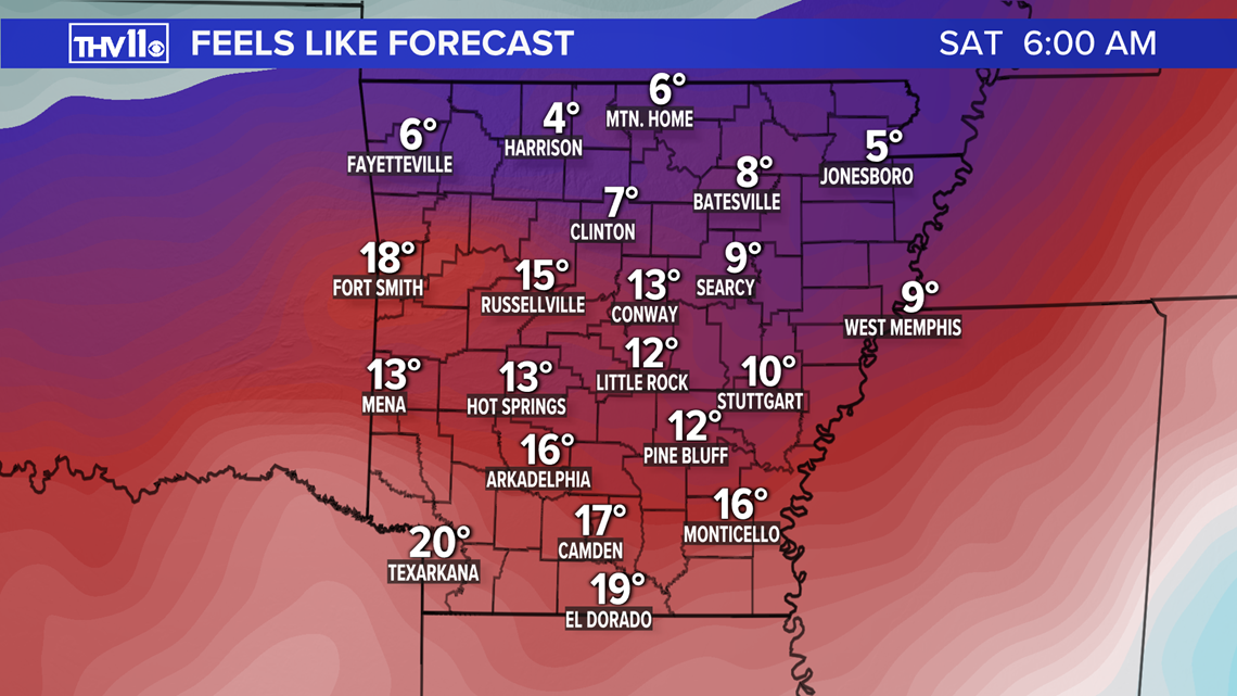
LITTLE ROCK, Ark — Here’s a look at the overnight forecast from THV11. Skies will be mostly cloudy and very cold with a NNE Wind at 5 to 10 mph. Wind chill values will feel like the single digits to lower teens by Saturday morning.


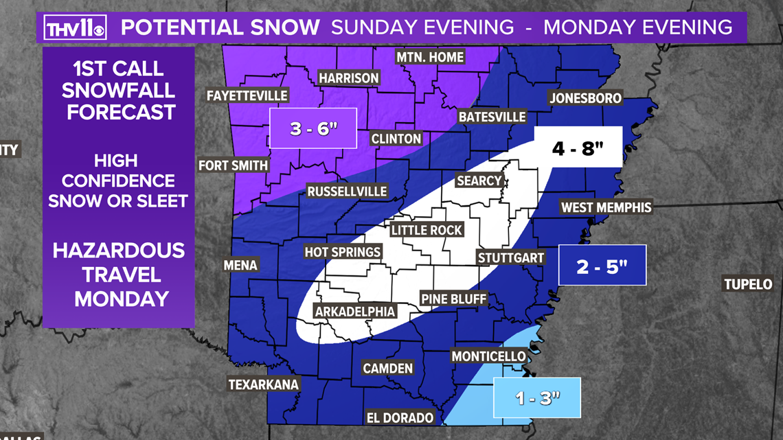
A developing winter storm will bring the potential for heavy snow amounts to most of Arkansas.
With cold air in place, it appears the primary precipitation will be snow. However, in the onset of precipitation, sleet may mix in.
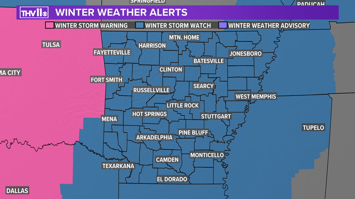
A Winter Storm Watch is in effect from 12 p.m. Sunday until 12 a.m. Tuesday.

Preliminary amounts indicate an area of 4 to 8” of snow could occur in central Arkansas. A wide swath of 2 to 5” outside of central Arkansas.
This forecast will be modified in the upcoming days, stay tuned to THV11 for additional updates.

If you think it has been cold over the past several days, get ready because the polar express is about to make a big delivery.
Temperatures will struggle to climb above freezing today and Saturday. By Sunday through Tuesday the mercury will stay in the 20s!

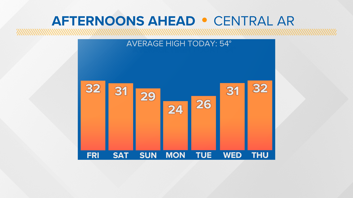
Combine those numbers with a wind 10 to 20 mph from N and NE and the wind chills will plunge to near or below zero.

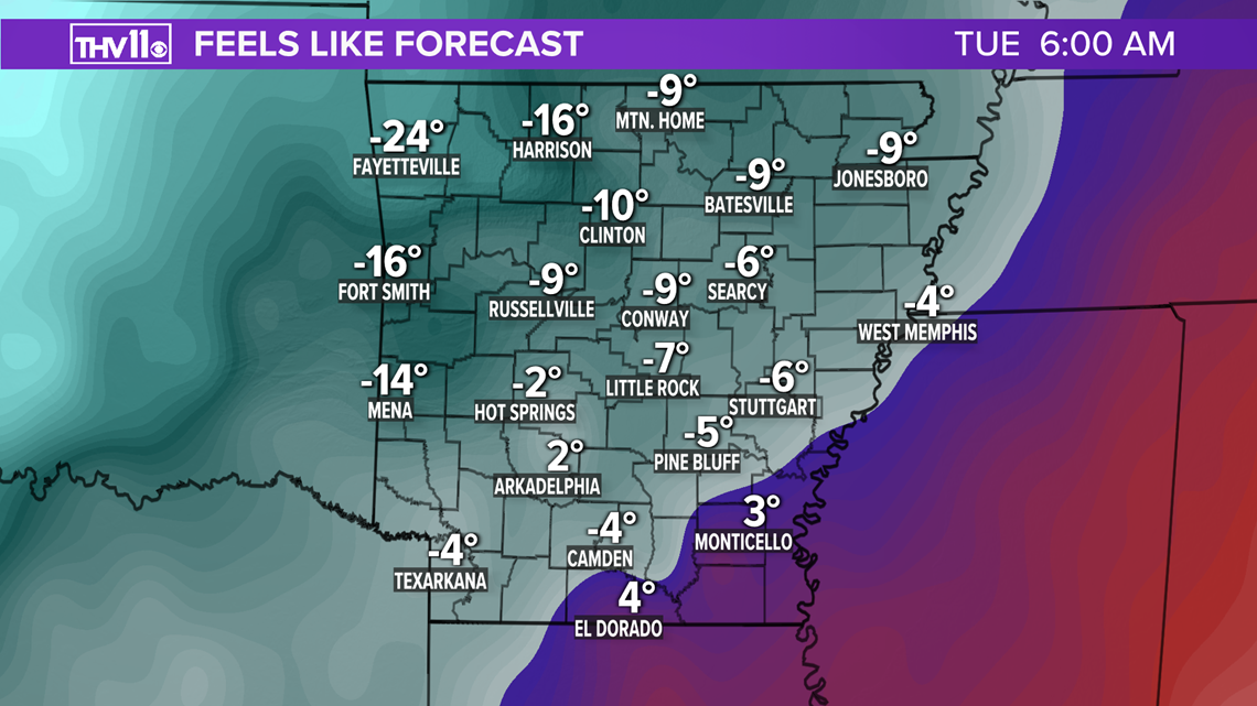
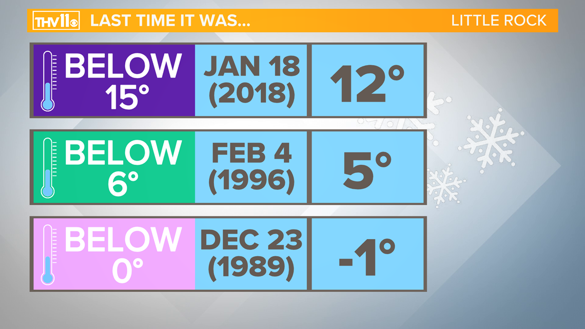
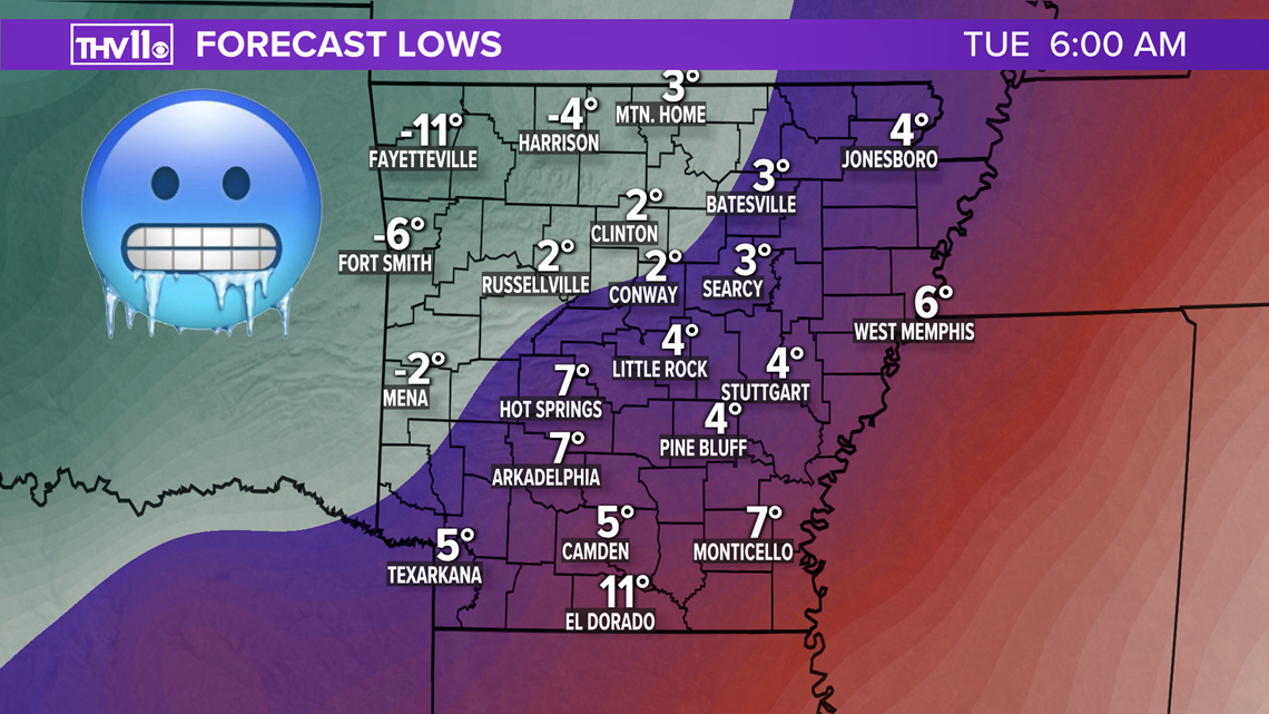
This is serious and dangerous cold. In fact, we have not seen this type of frigid conditions in the past 25 years! Some locations could dip below zero Tuesday morning, if there is snow on the ground.


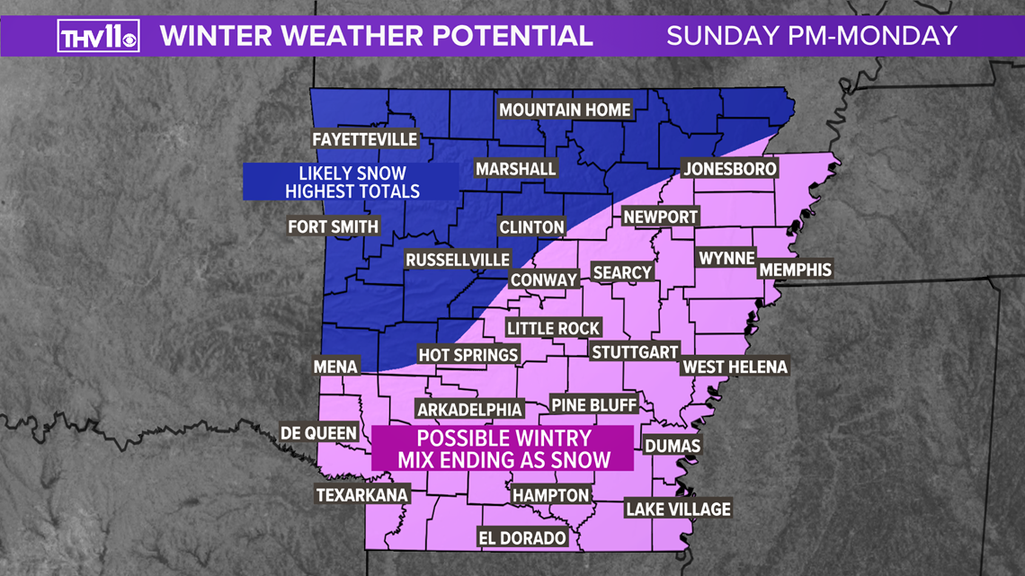
Speaking of snow, there is likely going to be another winter storm moving into Arkansas later Sunday afternoon and continuing through Monday.
Cold air will be locked in place at the surface, so we are not expecting rain. However, with warm air a few thousand feet above the surface at the beginning of the event it will be a mix bag of precipitation.
At this time it looks to be sleet changing over to all snow situation, Sunday night into Monday.
The Monday morning commute will likely be messy or even dangerous with ice or snow covered roads expected.
As for snow totals there is the potential of significant snow of several inches especially for locations to the north and west of the Little Rock.

A few things to remember with this arctic blast:
- Wear layers, a hat, gloves and keep warm. Hypothermia and frostbite are possible if exposed to the cold for too long unprotected.
- Protect the pipes as the mercury drops into the single digits Tuesday, uninsulated pipes will freeze and possible bust.
- Don’t forget the pets, make sure they are brought inside, or have a warm place and fresh water.
- Stay off of frozen ponds. Ice will form on the ponds and lakes but it must be at least 4 inches think to safely walk on.
- If traveling check the battery, fluids, tire pressure, and tread. Also pack blankets, food, and water in case you get stuck.
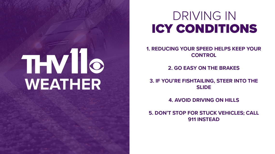
Here are a few safe driving tips when traveling on ice:

Stay tuned for the latest information here at THV11 and THV11.com. Be sure you download the THV11 App for up to date weather conditions in your area. And don’t forget to send your reports and winter pictures to 501-376-1111!