
Bushfires fueled by the hottest and driest year on record in Australia are taking a terrible toll on the country and its wildlife.
Maps and satellite images showing the scope of the destruction are making the rounds online, sometimes without context.
We verify if what you're seeing—and sharing— is what you think it is.
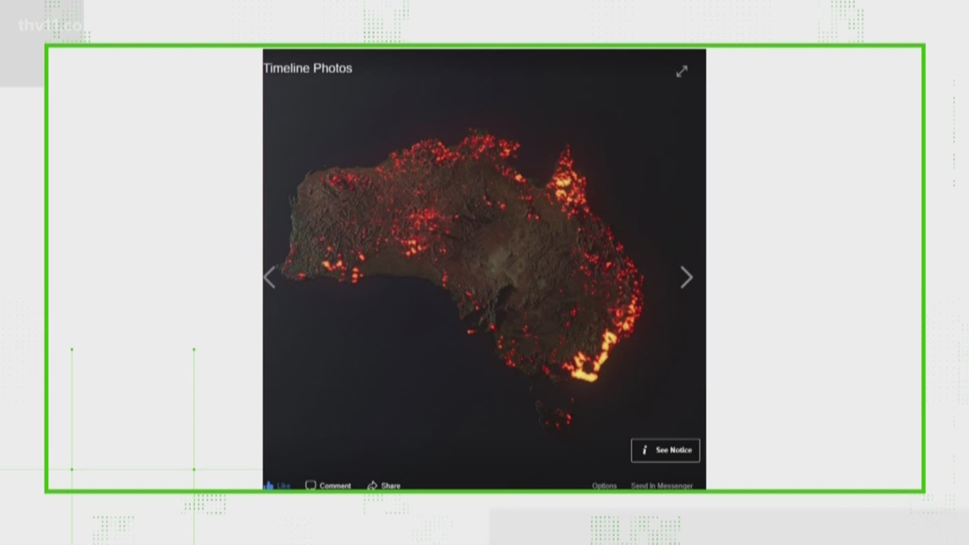
Satellite Images like this one:

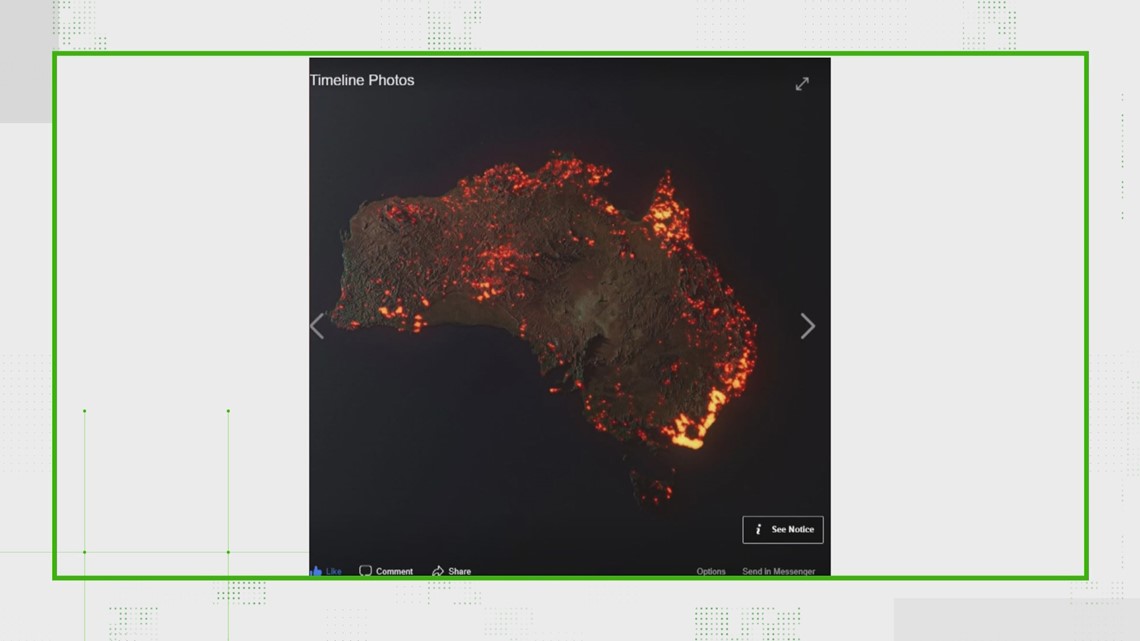
are meant to show the extent the fires that have burned in Australia.
However, it's important to understand that it is not a real photo of the fires currently burning.
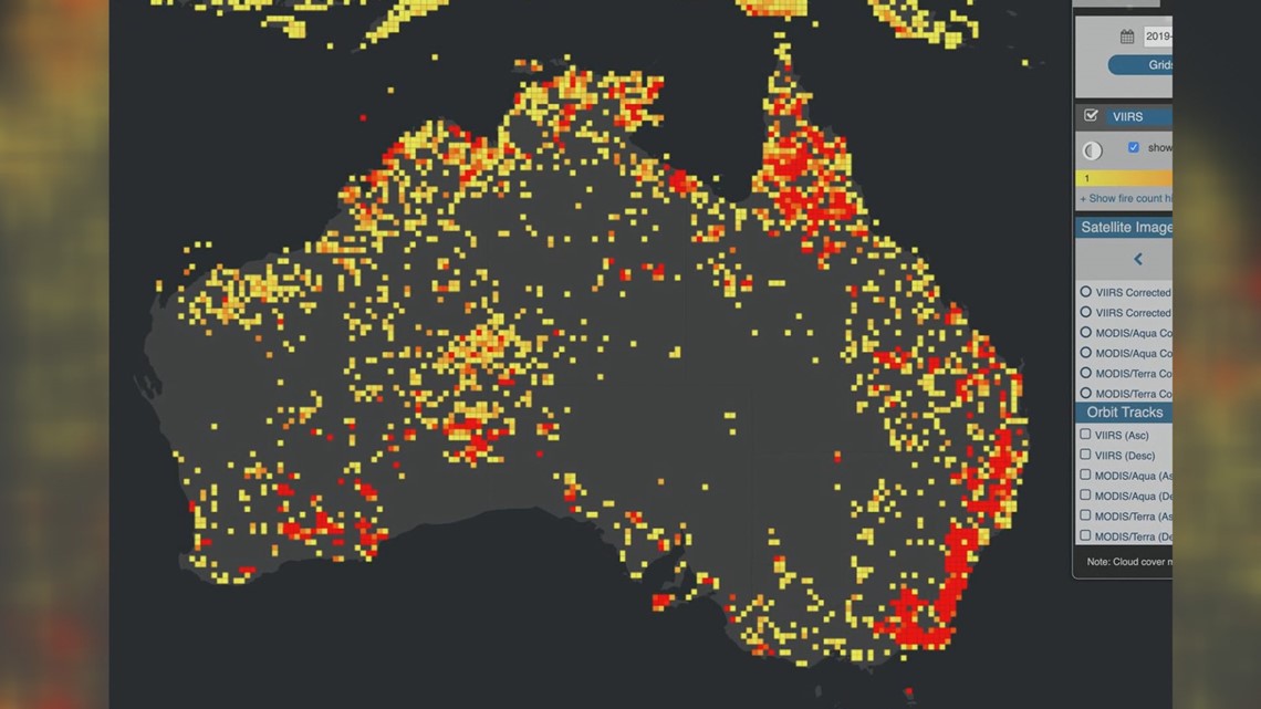
It was created using these NASA data points gathered by a satellite which shows the areas burned in all of 2019.

Then, a graphic artist replaced the points with glowing flares to make the image easier for people to visualize.
Matt Rogers is an Atmospheric Scientist and said it's a challenge when these types of things go viral on social media.
"They get out there. And people are interested, and you really want them to be interested, it would be worse if they didn't care," Rogers said.
The image, instead of a real photo of the fires actively burning currently, is better described as an info-graphic.
Matt Rogers develops similar looking products for NASA and NOAA in his lab at Colorado State University.
If you have anything you'd like our team to verify, email verify@thv11.com or reach out on social media.
MORE #VERIFY: