
ARKANSAS, USA — Saturday 9AM Update -- Rain and storms continue moving through the area. These thunderstorms will pose a severe weather risk through mid-afternoon for parts of East and Southeast Arkansas, where the risk has been downgraded to a "low" or level 2 out of 5. The potential for a brief tornado, hail, and damaging winds will persist through 5PM this evening.


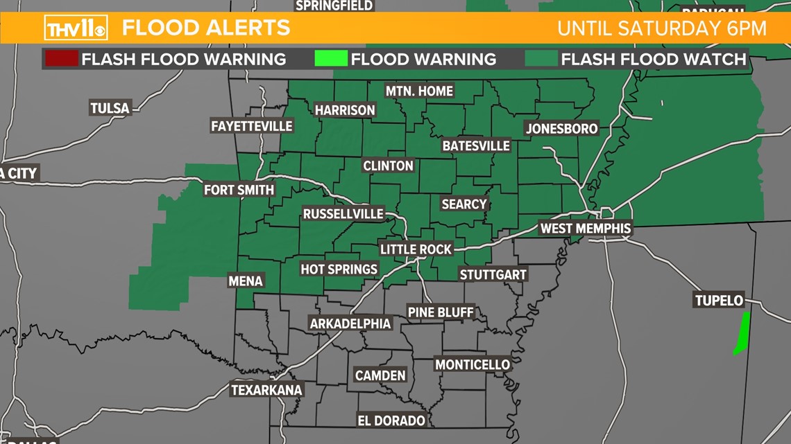
We've already seen 3-4 inches of rain in parts of the area, with more to come. A flood watch is in effect until 6PM Saturday evening.

- Tom and Skot
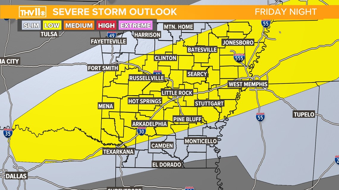
2021 will go out with a bang, quiet literally. Rain and thunderstorms are likely New Years Eve through New Years Day on Saturday.
Initially, rain will develop and move into west and north Arkansas as early as 6 p.m. this evening. Elsewhere across the state some scattered showers and storms will be possible.
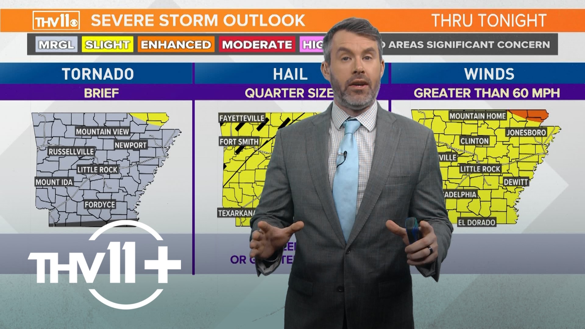
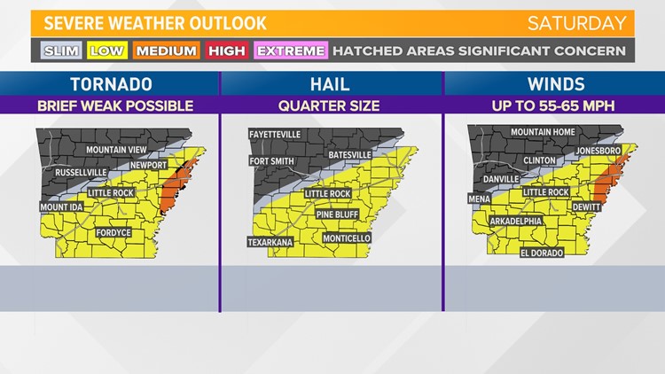
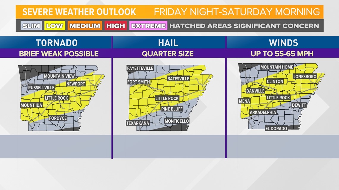
Tonight's severe weather risk is "low" or a level 2 out of 5.

This is what that risk looks like when broken down by individual hazards (tornado, hail, wind).

The potential for severe weather will continue well into Saturday, and increases in probability for southeast Arkansas places in east Arkansas are under a "medium" or level 3 out of 5 risk for severe storms.
A line of storms will enter western Arkansas between 6-8AM, moving east. Current model guidance suggest they will arrive in Central Arkansas between 10am-1pm, and eastern Arkansas between 12pm-3pm.

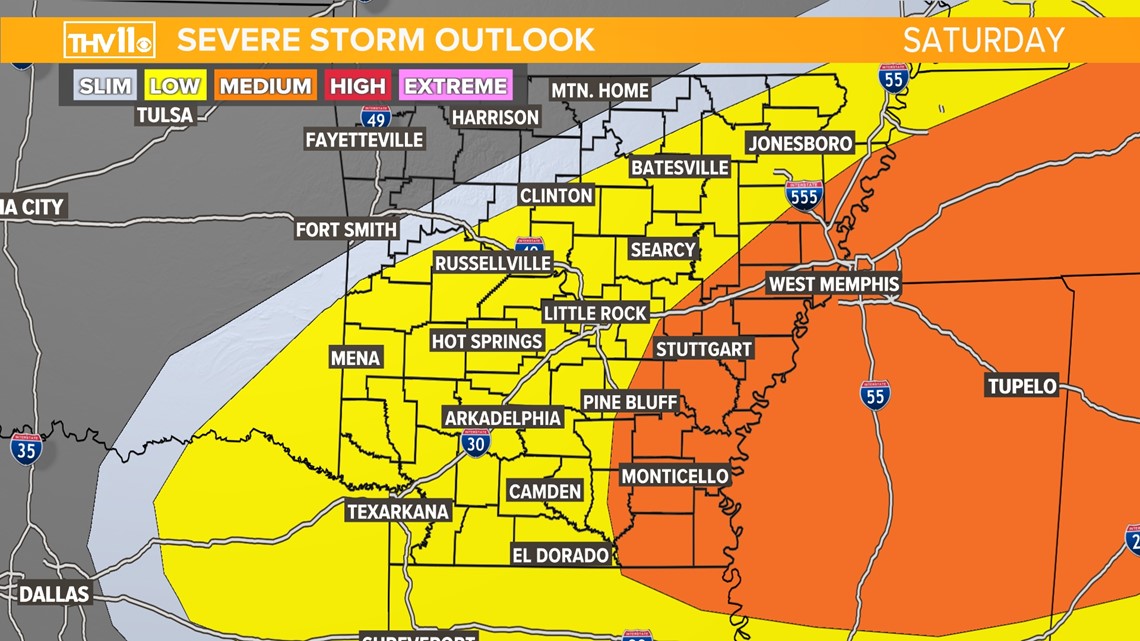
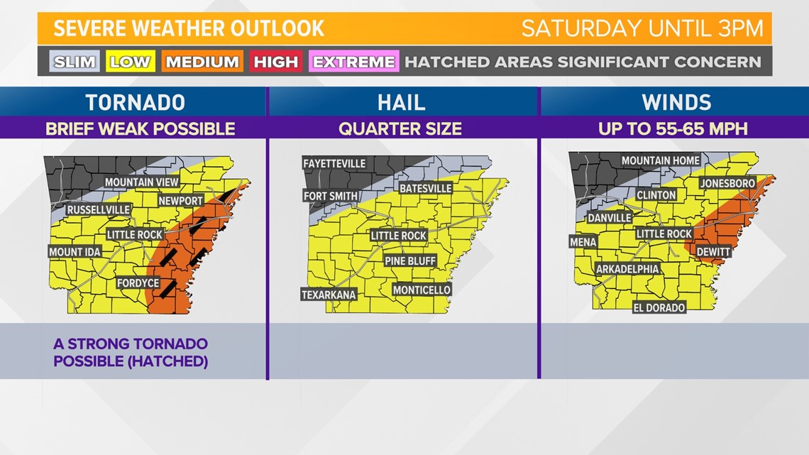
When broken down by specific hazards, Saturday's risk for severe weather shows the potential for tornadoes, a few of which may be strong, damaging winds, and hail. By 3PM most severe weather will have cleared the area.

Just as concerning as the severe weather potential is the likelihood of flash flooding. 2-4 inches of rain can be expected in some areas, with locally heavier amounts certainly possible. If you encounter flooded roadways, remember: turn around, don't drown!
Once the storms pass on Saturday, we may see some sunshine and temperatures will remain warm.
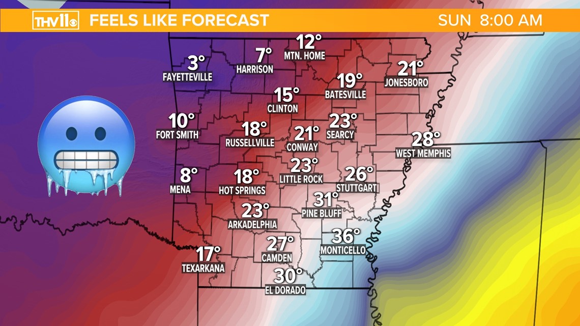
However, by late Saturday night and Sunday morning, the cold front responsible for the severe weather will have cleared the area, ushering in frigid air. Wind chill values Sunday morning will be as low as single digits in western Arkansas.