
LITTLE ROCK, Ark. — A strong cold front will move through Arkansas late tonight (Sunday) through the early morning hours of Monday. Ahead of the front conditions are warm and humid. This clash of airmasses sets the stage for potentially strong to severe thunderstorms.
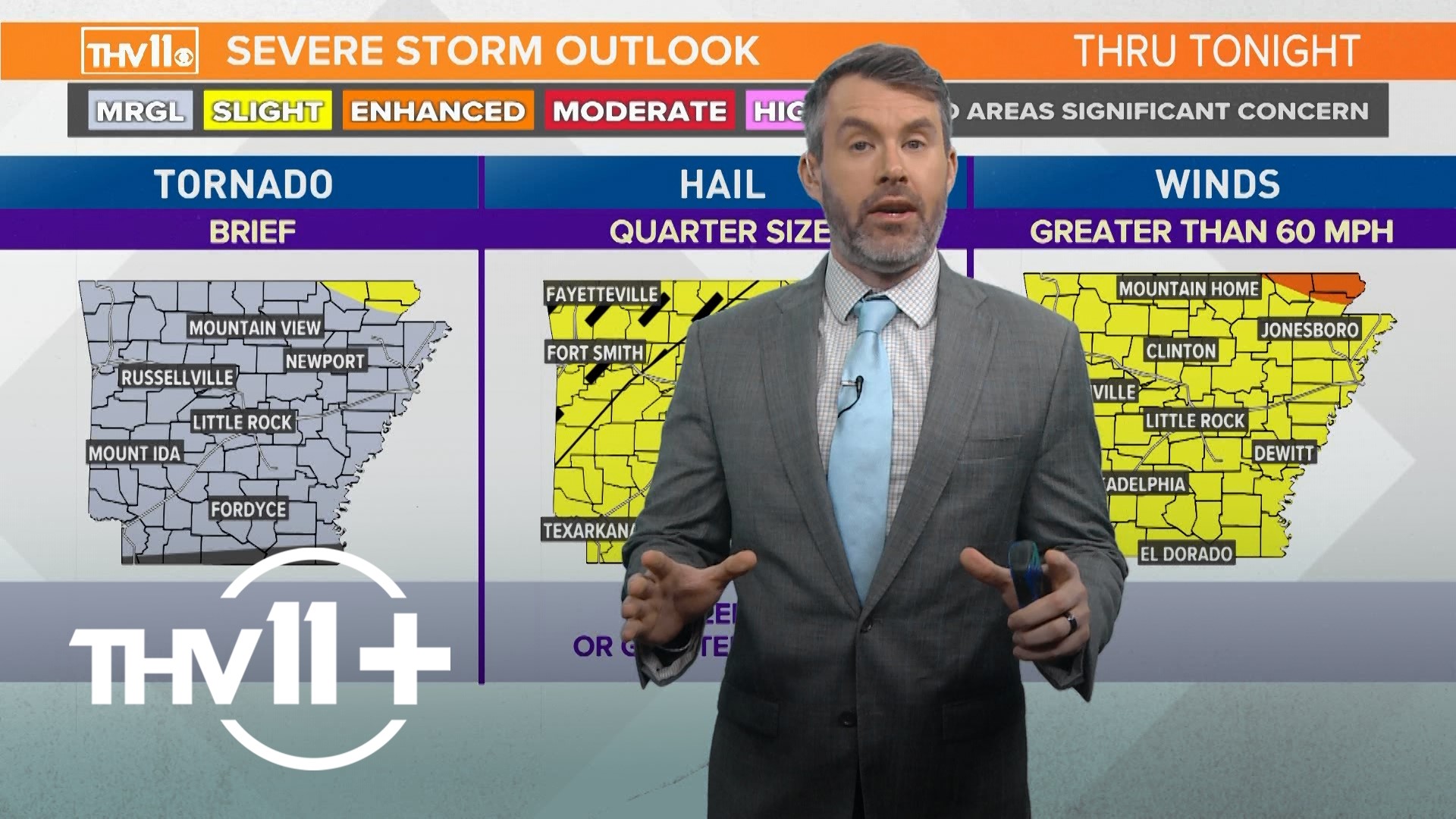
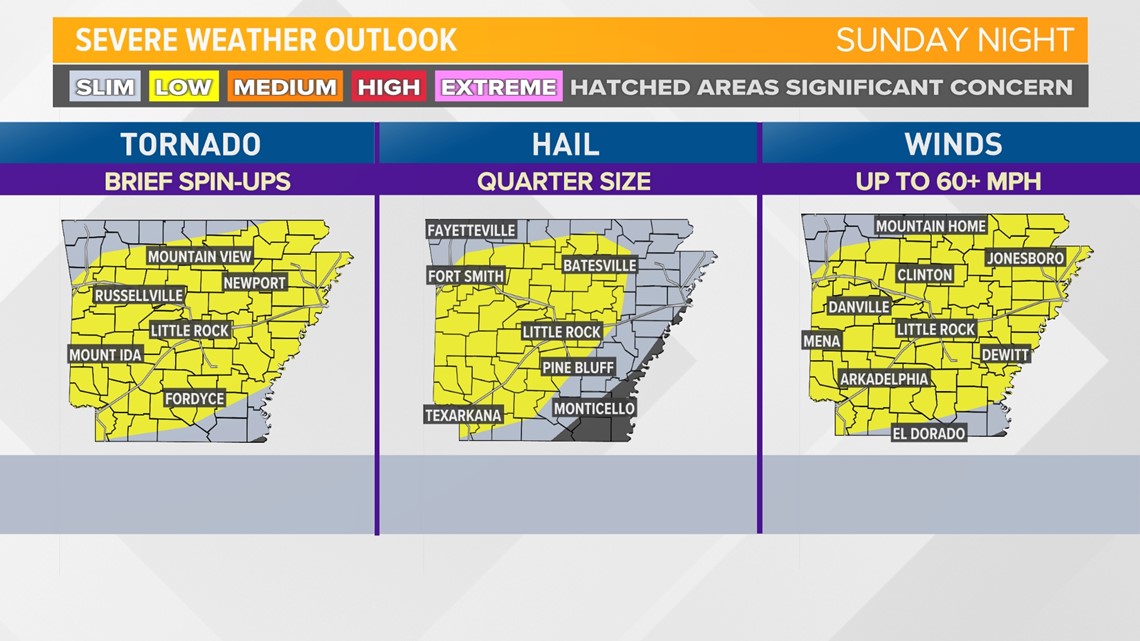
Given current ingredients, damaging winds up to 60 mph is the most likely hazard with tonight’s storms. However, up to quarter size hail and brief tornadoes can’t be ruled out.
Most storms will track through the area while many are asleep, so it’s recommended having multiple methods of receiving weather warnings should they be issued for your location. The THV11 app and NOAA Weather Radio are two good sources.
The current severe weather risk category for most of our area is "low", or a level 2 out of 5. That risk is broken down by individual hazards (tornado, hail, wind) below:

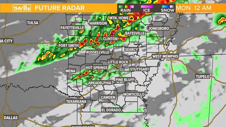
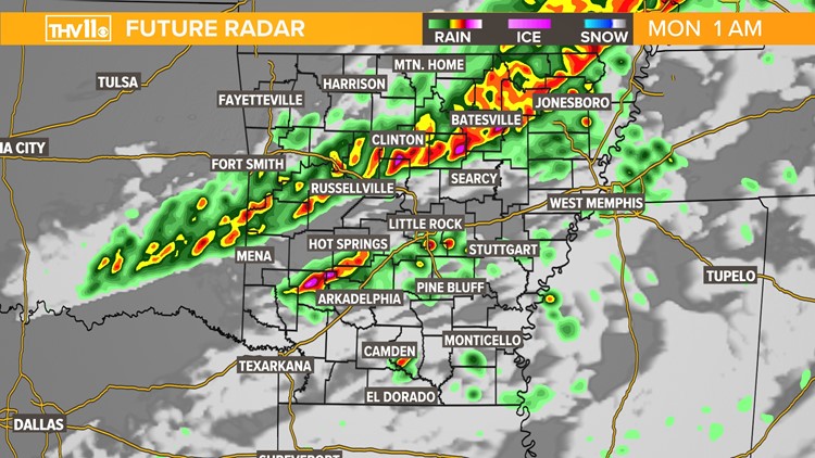
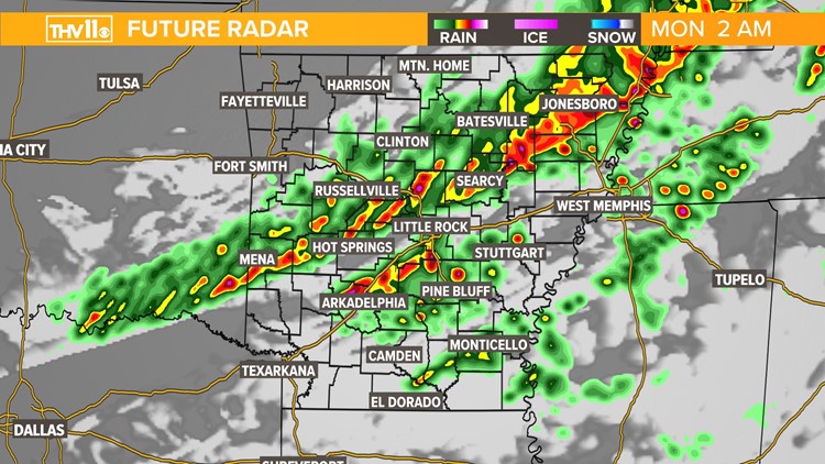
Future Radar model guidance suggests storms will move into Northwest Arkansas as early as 9PM this evening, tracking from the NW to the SW.
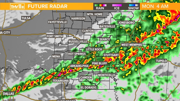
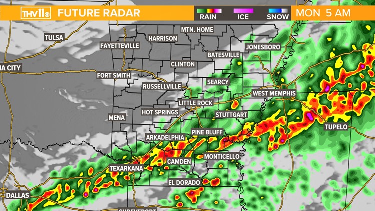
This timeline would bring storms into the greater Central Arkansas area between 1AM – 3AM and Southeast Arkansas between 3AM – 5AM. These are estimated times.
Check back for updates and tune in to Chief Meteorologist Tom Brannon tonight on THV11 for the latest forecast.
Severe weather possible


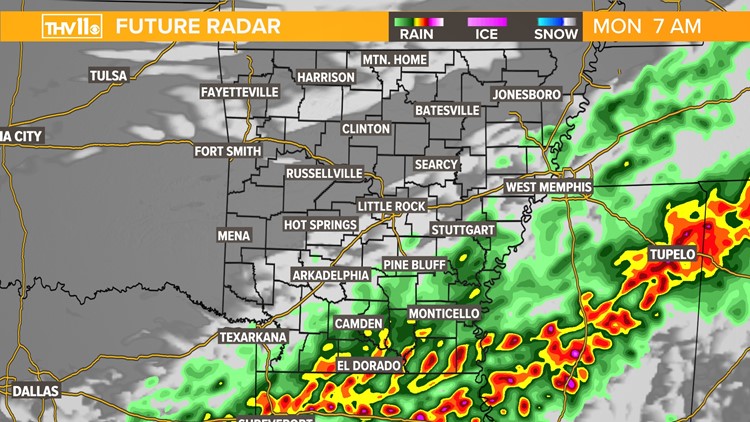
Once the cold front passes your area you’ll notice a shift in the winds. They will be become northerly, and could be rather breezy. This will usher in much cooler temperatures for our new work week.
Additional chances for rain and storms are found in this week's extended forecast.