
There is a tornado watch until 7 p.m.
A line of storms moving through this afternoon could be strong to severe and produce damaging straight-line winds & possible weak quick spin-up tornadoes.
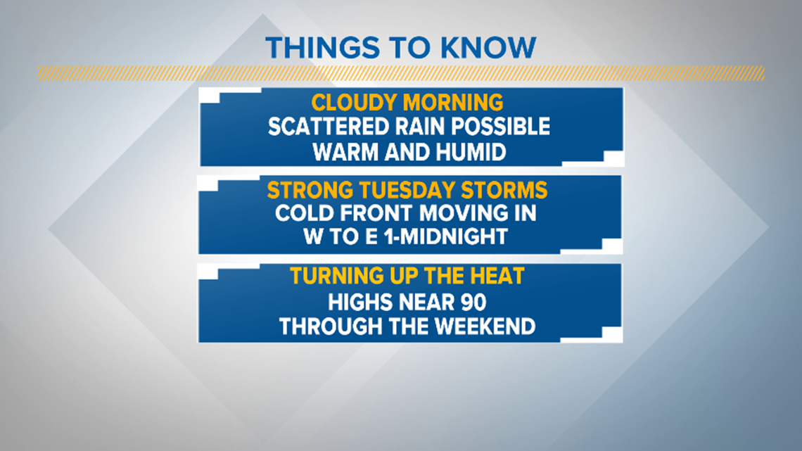
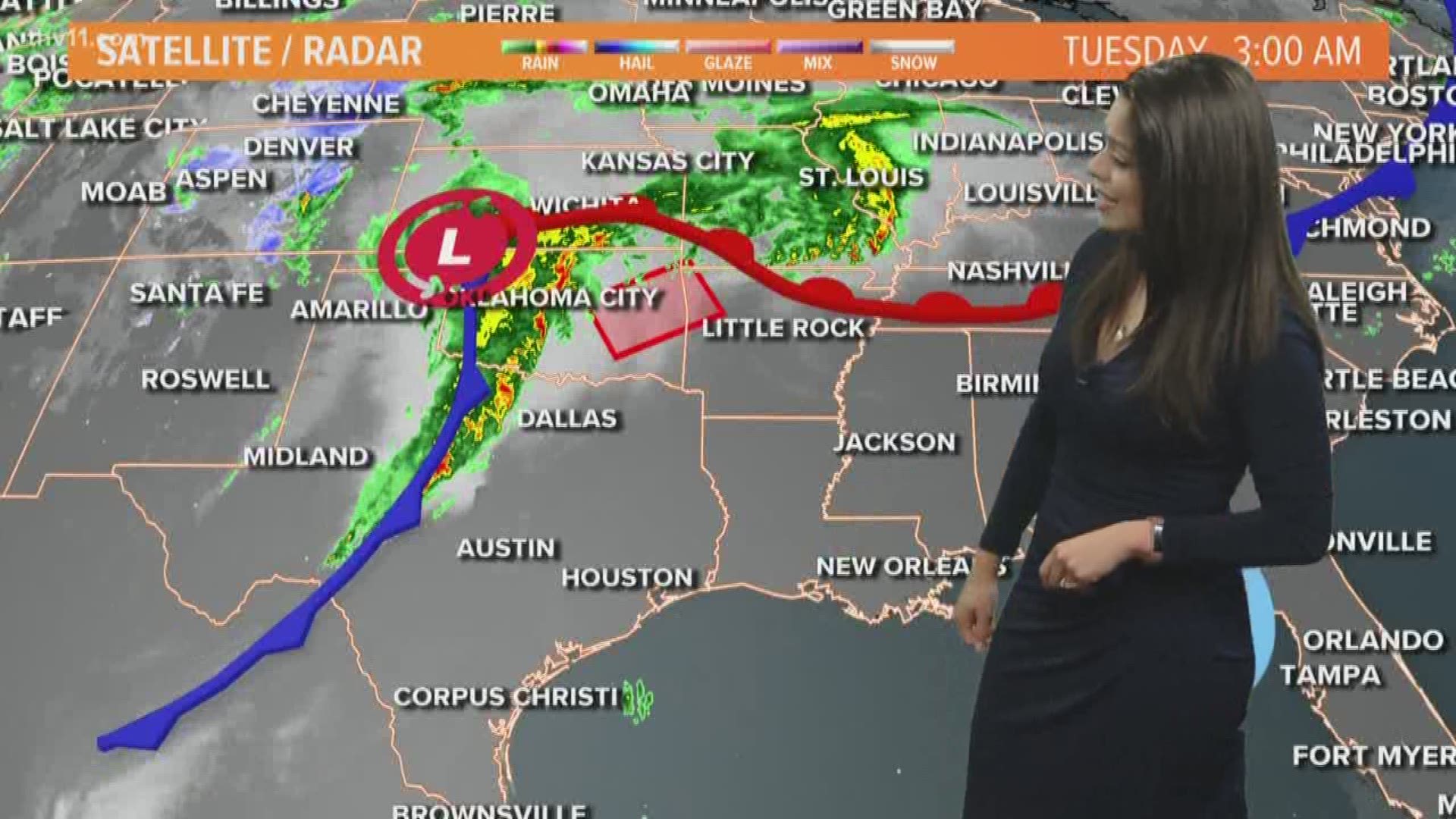
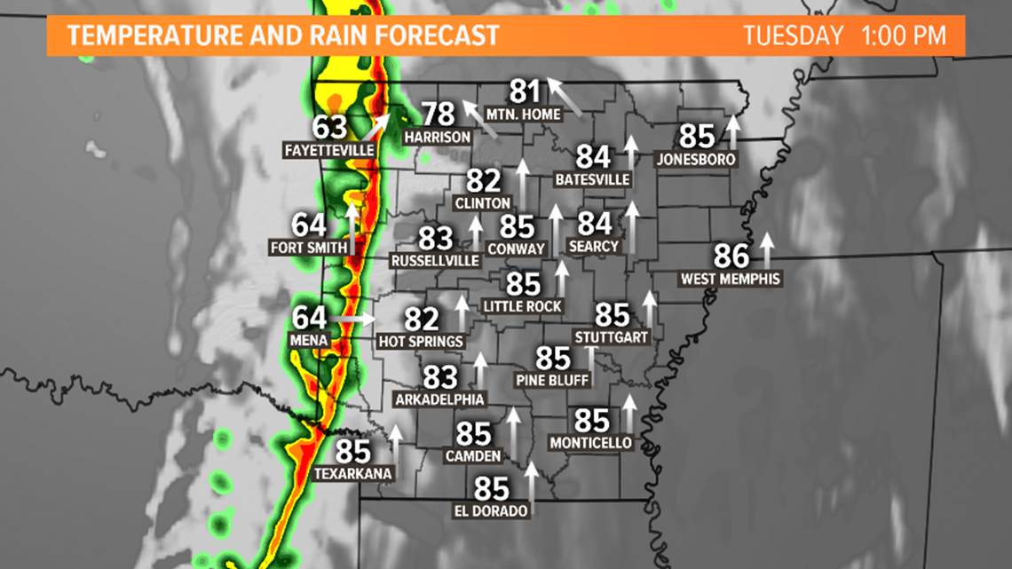
The warmer weather this morning is thanks to a warm front that has moved north. The low that is driving the system is strong and close to Arkansas. That is why windy weather is also expected today. Winds will be out of the south at 10-20 mph. Wind gusts will be highest across E. Arkansas at 30-40 mph at times.
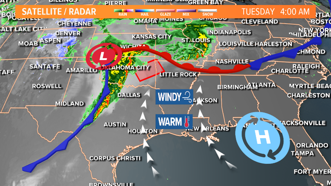
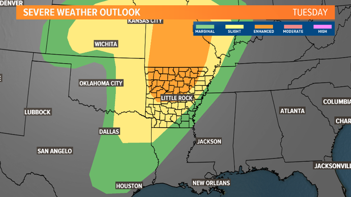
The line of storms this morning is still trekking through Oklahoma and Texas moving from west to east. The severe storms will not be as widespread as Oklahoma and Texas saw on Monday, but the threat still exists. The northern half of the state is under an “Enhanced Risk,” which is a category 3 out of 5 for likelihood of seeing the strong to severe storms.

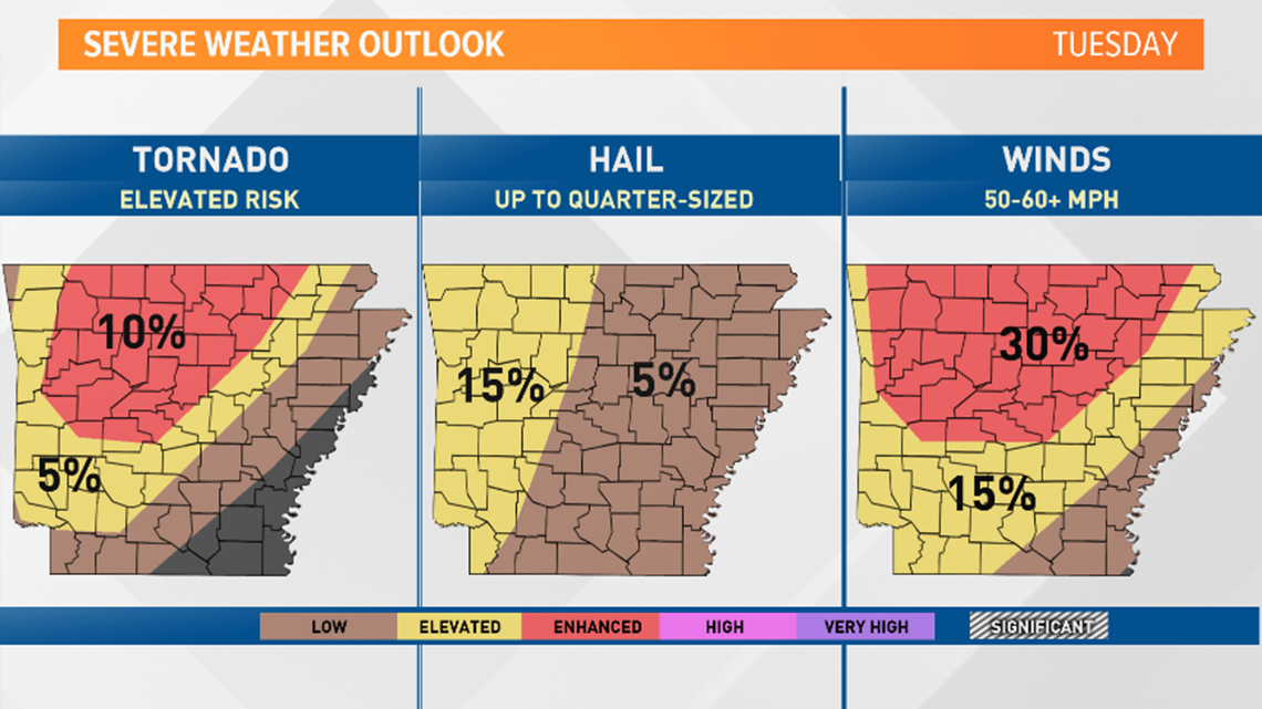
Here are the risks broken down by category. By far the highest risk will be for strong winds, followed by hail, and then the tornado risk. Notice the tornado risk is lower than the high wind risk for the same area.
Meanwhile, heavy rain is also possible. Central Arkansas could see between ½ an inch to an inch and ½. Higher rain will be across NW Arkansas.

TIMELINE:
Keep in mind, this is just one model. The timing could differ by an hour or two.
The line of showers and thunderstorms will enter the state just after noon. This is where we could see strong winds ahead of the line, hail, and a tornado threat.

The line with the same threats will move into Central Arkansas around mid-afternoon.

The line looks like it slows down as it moves into the eastern half of the state.
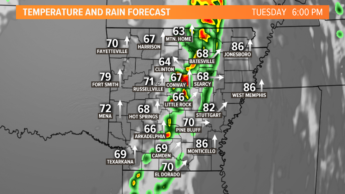
Our eastern counties should be aware between 6 p.m. to midnight.
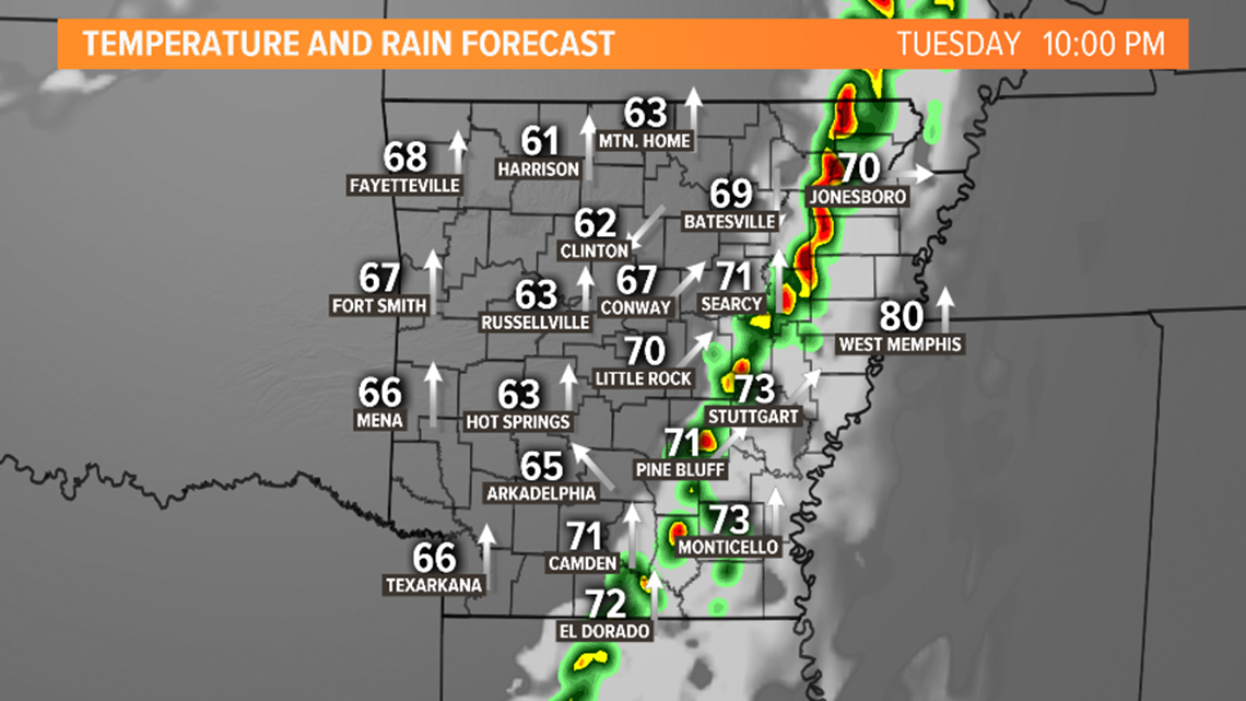
The line moves out of the state just after midnight. Just a few lingering showers expected Wednesday morning.

Today is a day to be weather aware. Have the THV11 App downloaded and electronics charged. The THV11 team will be here all day watching for you.