

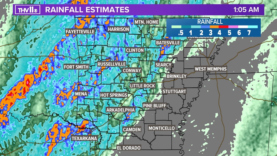
ARKANSAS, USA — 1:08 a.m. - Little Rock's hourly rain gauges clocked 1.71in. + 1.44in. + 1in. in the last 3 hours alone.

-----------------------------------------
The potent storm system is on track to arrive tonight bringing with it a potential for widespread wind damage, tornadoes and flash flooding.

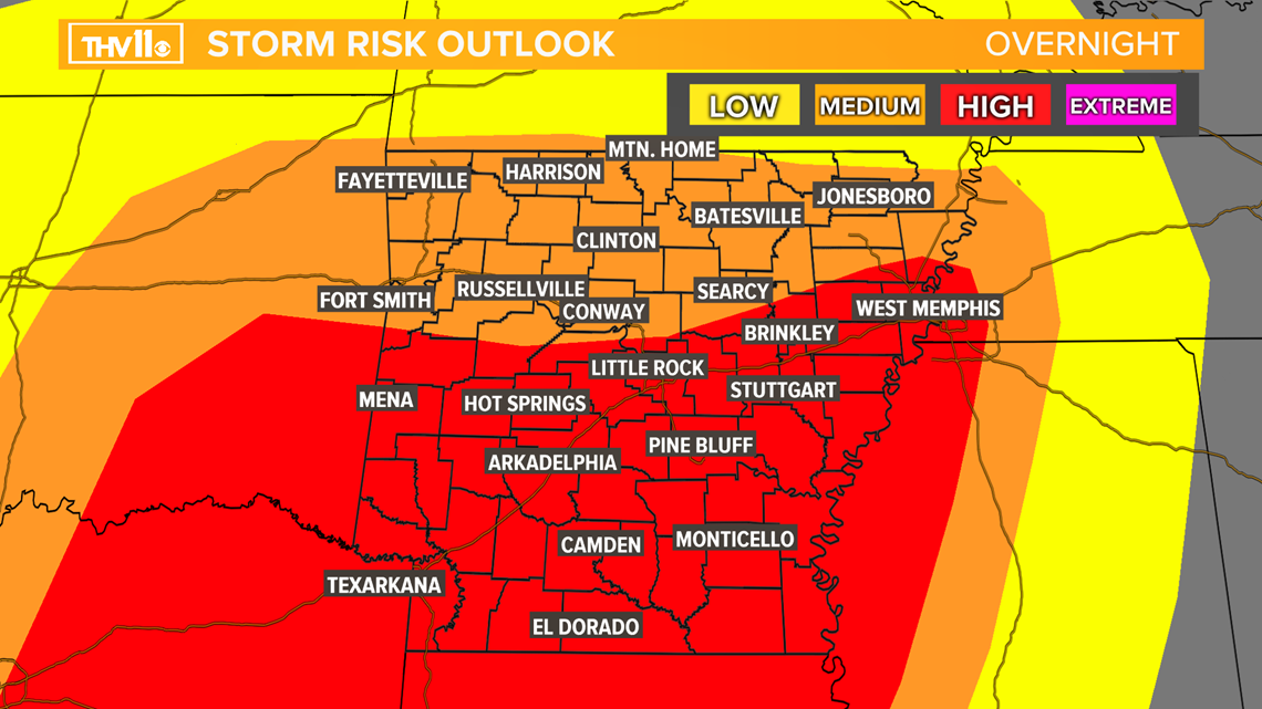
Here's the level of impact we're expecting for damaging wind gusts. Some wind gusts have the potential to exceed 50-60 mph, please take all warnings seriously.
Tornado impact also falls in the medium to a high category with this system. Tornadoes could be more intense and last longer than usual.
FLASH FLOOD WATCH:
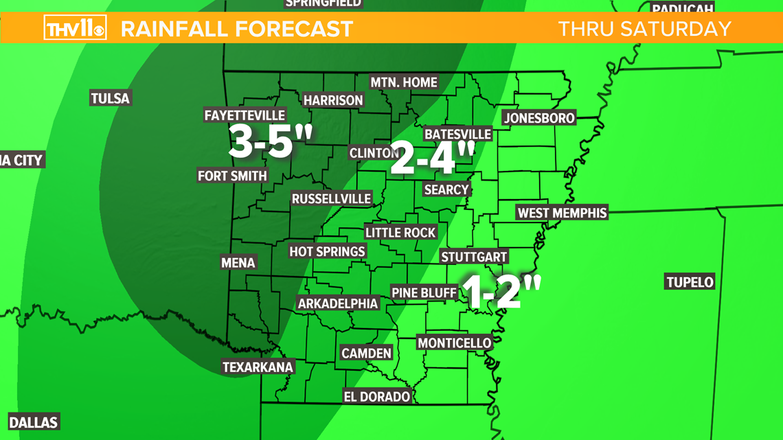
Several inches of rain are in the forecast with this system.
The most torrential rain during Friday evening and persist into Saturday.
Flash flooding will be possible for small creeks and streams, low lying areas, and poor drainage locations.

Here is what you need to know:
Saturday: Early in the morning, storms could be severe through 5 am.
The temperatures will be turning colder, dropping through the day from the 50s into 40s.
Rain could end as a wintry mix to snow in northwest Arkansas. A light accumulation of up to 1” looks possible.
The Weather Set-up
For severe storms to develop, the atmosphere needs to have moisture, heat, something to lift the air, storm fuel, and higher winds above the surface.

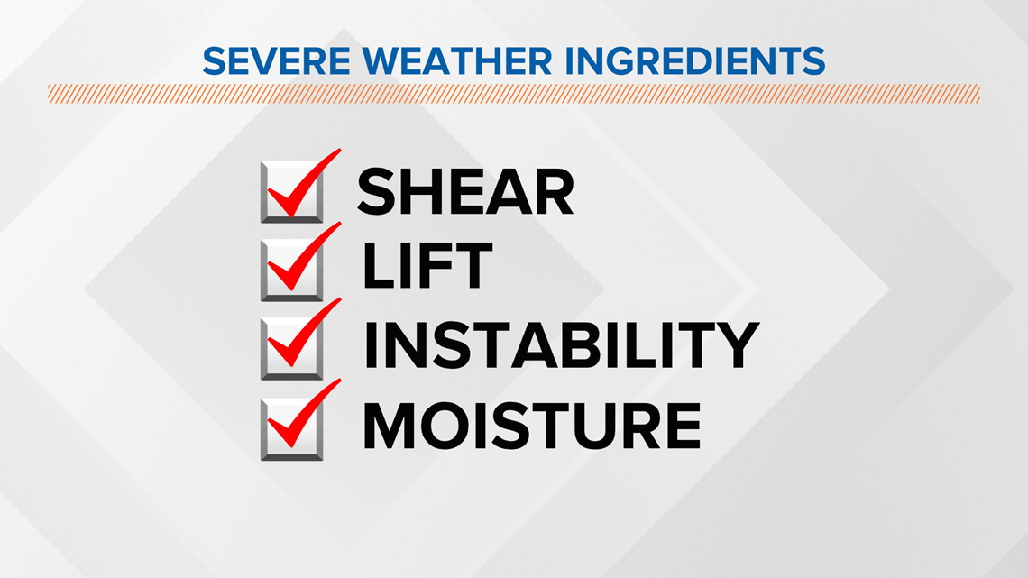
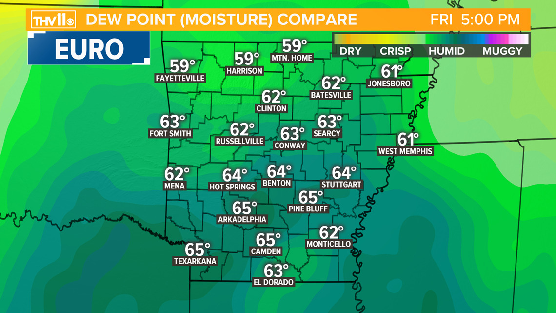
We will have plenty of moisture in the atmosphere, as humidity increases.
Once Dew points rise to at least 55°, the environment is ripe for storms and heavy rain.

Temperatures will warm well into the 60s and low 70s on Friday afternoon.
Warm air creates buoyancy in the atmosphere and provides energy for storms to tap into.

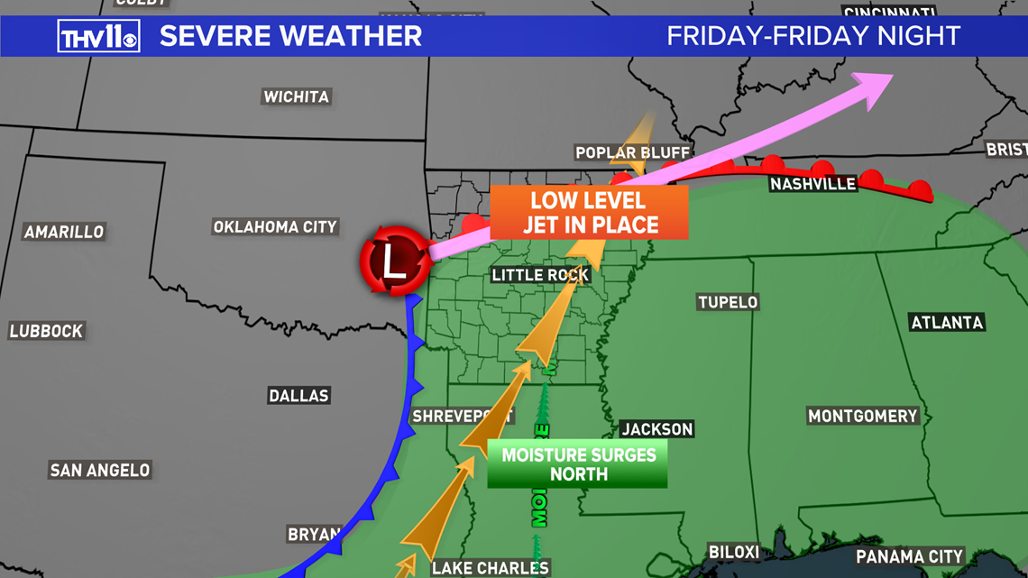
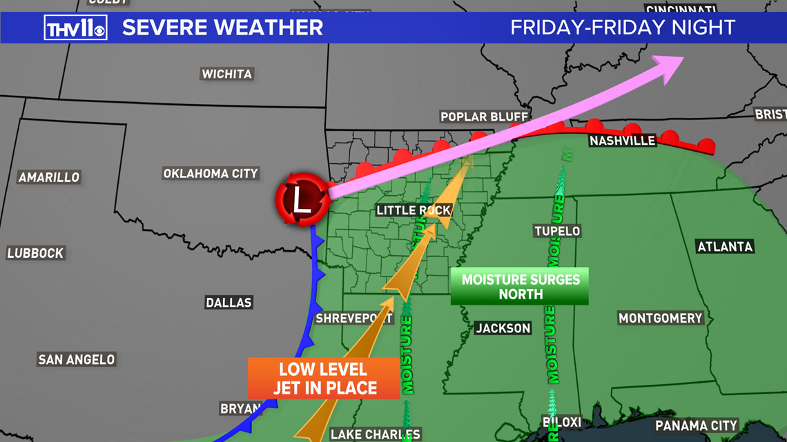
A key ingredient for severe weather is fast-moving air at 5000 feet above the surface; this is called the low-level jet! The forecast overnight shows winds of 60 to 80 mph over central Arkansas at this level.

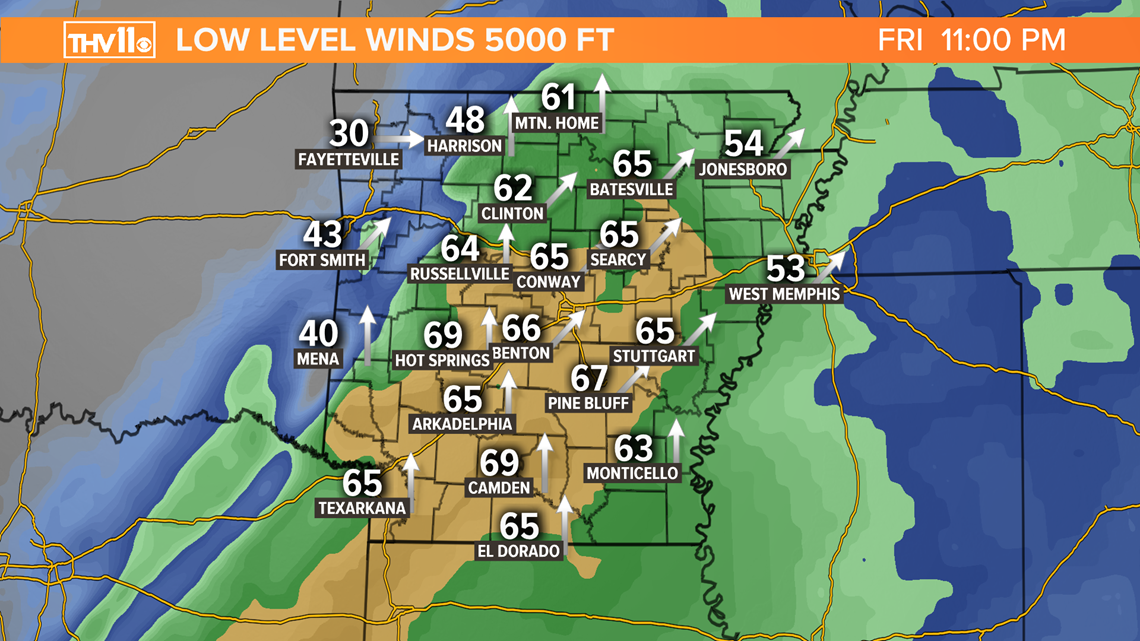
Wind changing direction and speed as you go up in the atmosphere produces “SHEAR”. When shear is in place storms could rotate and produce tornadoes.

Stay tuned to THV11 through the rest of the week for the latest updates.