

LITTLE ROCK, Ark. — 11:30 AM Update
A line of showers and storms continue tracking east. This line will move into an area more favorable for severe weather as it moves east of Little Rock. An additional tornado watch will be likely for parts of east Arkansas.
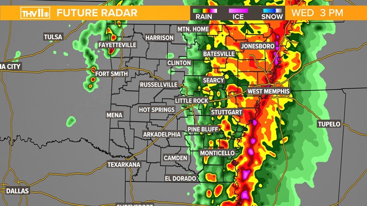
Locations west of Little Rock are in the clear.
------------------------
A line of storms packing heavy rain, vivid lightning and gusty winds will charge across the state Wednesday.
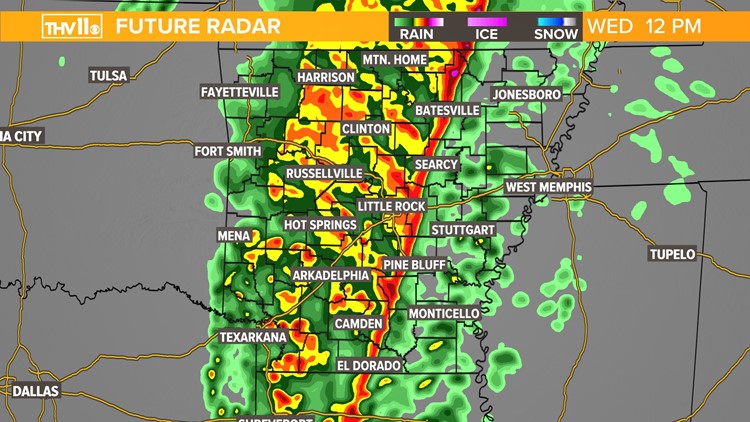
The line of storms will intensify through the morning into the afternoon as it moves east of the Little Rock metro.
Prior to its arrival, we’ll begin to see strong winds across the state into Wednesday with sustained winds of up to 35 mph and gusts as high as 50 mph possible. Therefore, a wind advisory has been issued for most of the state starting Wednesday and lasting through the evening.
Power outages will be possible before the storms arrive, so make sure you have your phones charged and several ways of getting warnings.
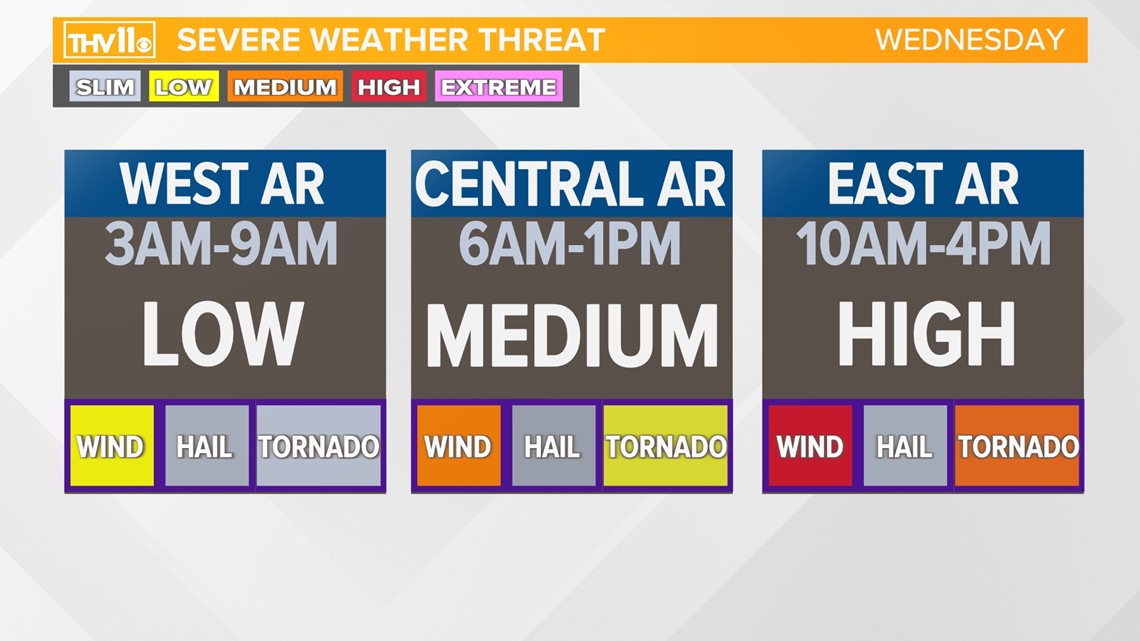
The Storm Prediction Center has most of the eastern half of the state under a MEDIUM risk for severe weather for Wednesday. However, southeastern areas and counties along the Mississippi River are under a HIGH risk.


All modes of severe weather will be possible with this event. Damaging wind gusts of up to 60-80 mph are the primary threat.
Large hail will be isolated, because the lack of storm fuel for clouds to grow very high in the atmosphere.
Quick tornadoes may develop within the line for mainly eastern and southeastern portions of the state where there is enough storm fuel in place that can help with the development along with the wind energy. Some of these could be strong, but that threat is more isolated due to limited fuel.
A tornado watch will likely be issued for a large part of central and east Arkansas Wednesday morning.
The highest threat of severe weather is for east and southeast Arkansas.
Stay weather aware from the morning through the early afternoon hours.

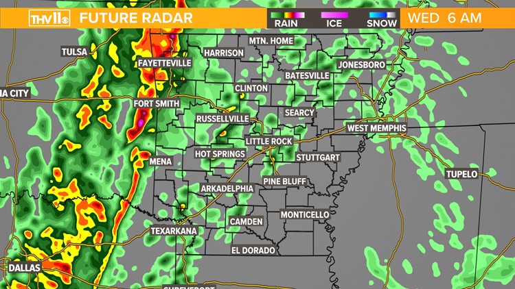
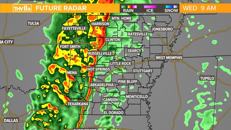
Below is an estimated timeline of severe weather of what radar could look like:
Strong to severe storms likely for some across Arkansas Wednesday


The severe weather threat will be over in the early evening before sunset, with a few lingering showers behind the front possible. We’ll be dry and cool for much of the overnight hours into Thursday morning.
The THV11 Weather Team is watching the weather situation very closely and will keep you informed throughout the day.
Make sure to download the THV11 app and stay tuned to the changing conditions.