

With warm fronts moving through the state, severe weather is expected early Saturday, March 9. Our weather team is preparing for team coverage, being there for our viewers every step of the way.
Timeline | March 8 & 9
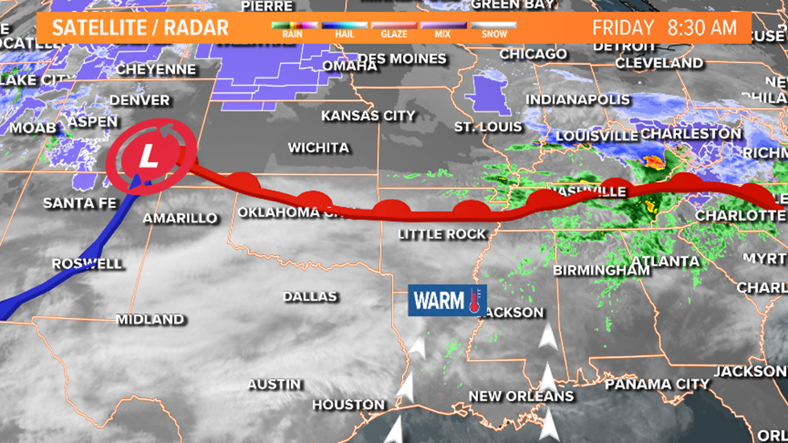
A warm front is stalled across the state. This is the reason we saw the clouds, fog, mist this morning. Overnight, the warm front will push north providing more moisture and warmth across the state. The approaching front will interact with that warm airmass to create the thunderstorms.
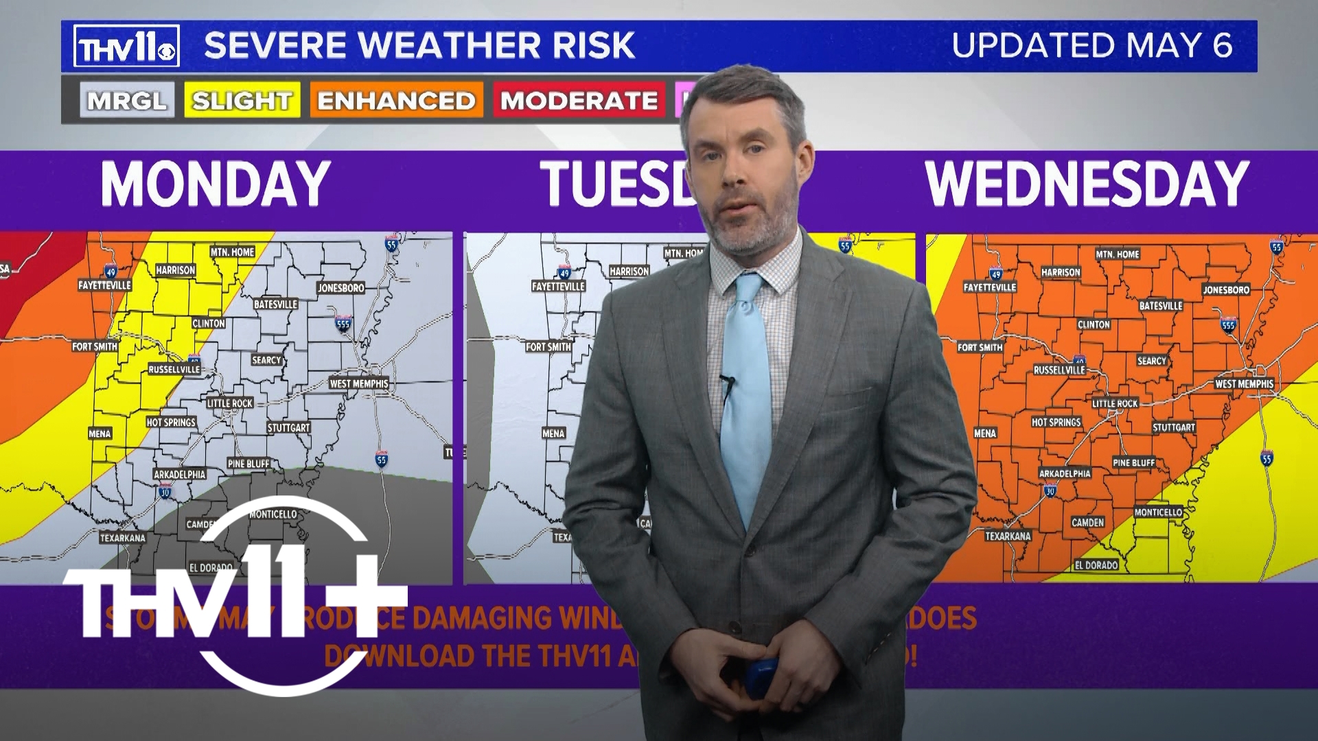
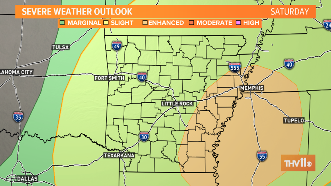
The highest threat for severe weather will be along our eastern counties and areas south of I-40. The storm prediction center has an Enhanced Risk for severe weather. This is a category 3 out of 5 for likelihood of seeing the strong to severe storms. The more east you are, the more likely you are to see a strong storm.
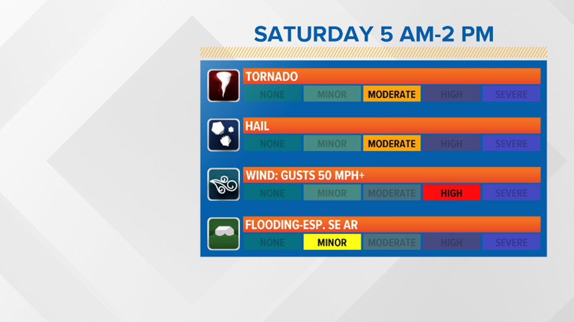
The main threat will be the strong wind. Secondary threats include hail and the potential for tornadoes. The flood threat is low because of how fast the initial line of storms will move through.

The rain comes in two rounds. The first round of rain will move in around 5 am across our western counties. Heavy rain and strong winds possible here. Not ruling out hail.
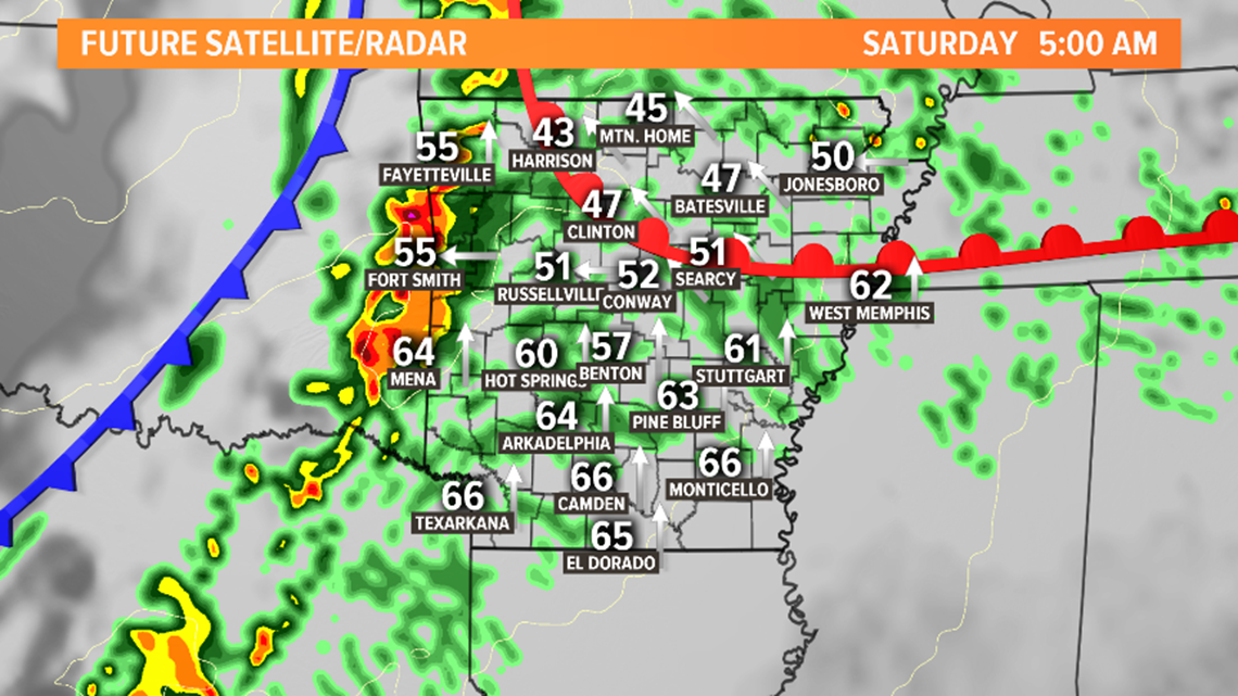
This line quickly moves east into central Arkansas between 7 a.m. – 9 a.m. Strong winds and hail will be the threats.
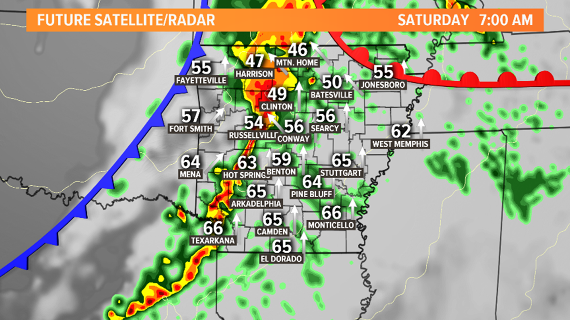
The initial line of showers and thunderstorms moves into east Arkansas mid to late morning and out of the state by noon.

Depending on how much moisture and energy remains, we could see more storms develop along the front in the early afternoon. This is more likely to happen along our eastern counties.

It will be windy through Saturday afternoon as the front pushes through. Saturday evening, night, Sunday look dry. This weekend won’t be a complete washout. Have a backup plan and a way to get warnings Saturday 6 am – 2pm!