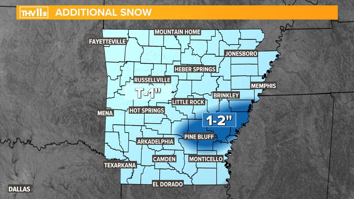
LITTLE ROCK, Ark. — The second round of snow and sleet showers is moving through Arkansas this morning and is expected to continue through early afternoon. Additional light accumulation is possible for many, though the highest totals will be found in East-Central and Southeast Arkansas.
While the northern half of the state will likely see precipitation in the form of all-snow, a sleet/snow mix is expected the further south you go.
Sleet is defined as ice pellets that bounce off objects and sting your face. Sleet does not cling to trees or power lines, so power outages should be very isolated with this event.
The snow will be a dry, powdery kind that is easy to brush off and won't be good for making snowballs or snowmen. Sorry kids!
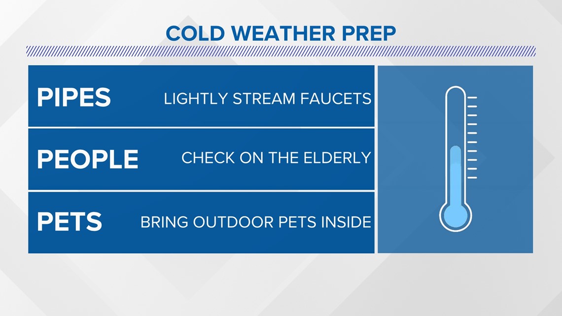
Most of the state's major highways and interstates are snow-covered and travel isn't advised. If you must travel be sure to pack plenty of water, food, warm clothes, and blankets in case of an emergency.

When and what to expect
Most of the moisture for Monday will stay in south Arkansas, and the rest will see periods of snow.
All wintry precipitation will be over by Monday evening.
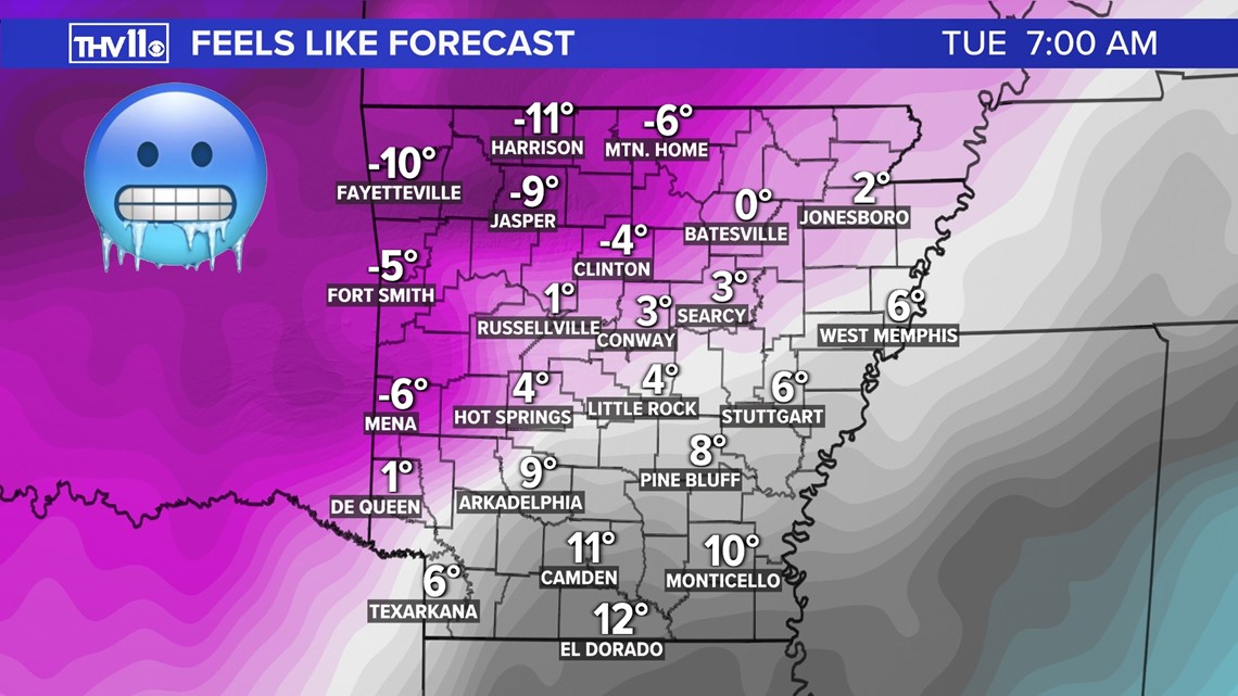
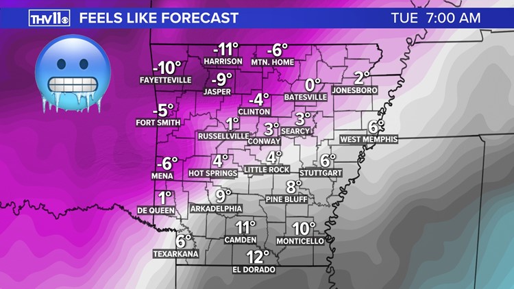
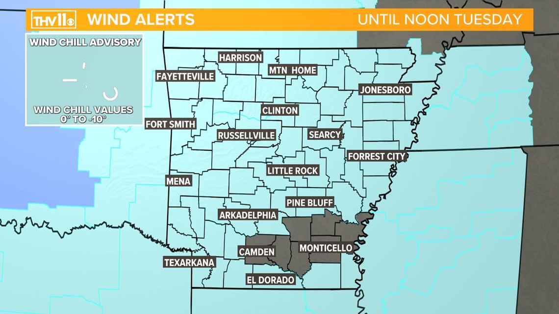
The frigid temperatures are here to stay for several days and the combination of subfreezing numbers and a breeze will make it dangerously cold to be outside unprotected.
Wind chills will drop well below zero and wind chill warnings and advisories are in effect through Tuesday.

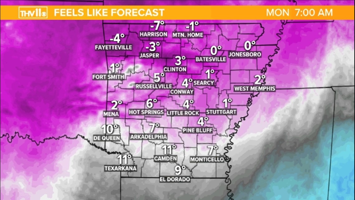


Temperatures are expected to drop into the single digits and low teens for early morning temperatures, with wind chill values even colder than that!
The high temps may not even reach above freezing until mid-to-late week, next week.